
- Startseite >
- Flüsse >
- Wasserstand >
- Obere Donau >
- Kelheim >
- Jahresgrafik

Jahresgrafik Kelheim / Donau
Wasserstand vom 02.06.2020 bis zum 01.06.2021
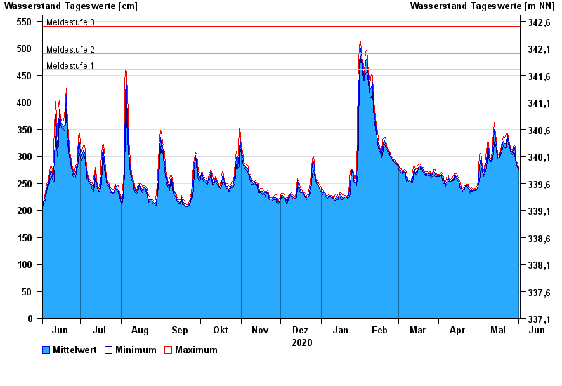
- Meldestufe 1 460 cm
- Meldestufe 2 490 cm
- Meldestufe 3 540 cm
- Meldestufe 4 600 cm
- Hochwassergefahrenfläche HQ100 810 cm
- Hochwassergefahrenfläche HQhäufig 680 cm
| Datum | Mittelwert [cm] | Maximum [cm] | Minimum [cm] |
|---|---|---|---|
| 01.06.2021 | 277 | 279 | 275 |
| 31.05.2021 | 282 | 287 | 279 |
| 30.05.2021 | 291 | 294 | 287 |
| 29.05.2021 | 308 | 318 | 294 |
| 28.05.2021 | 319 | 322 | 310 |
| 27.05.2021 | 306 | 310 | 303 |
| 26.05.2021 | 310 | 314 | 307 |
© Bayerisches Landesamt für Umwelt 2024