
- Startseite >
- Flüsse >
- Wasserstand >
- Obere Donau >
- Hasberg >
- Jahresgrafik

Jahresgrafik Hasberg / Mindel
Wasserstand vom 23.06.2023 bis zum 22.06.2024
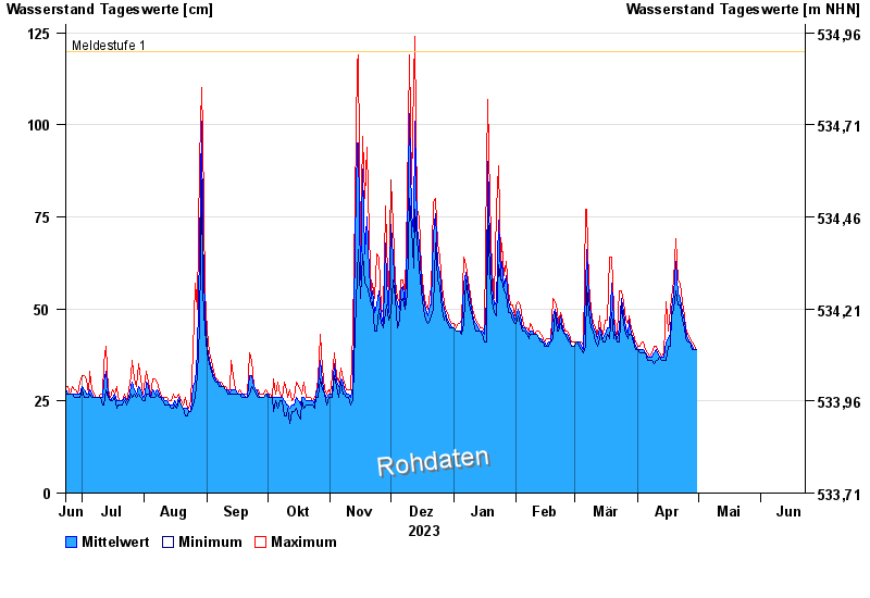
- Meldestufe 1 120 cm
- Meldestufe 2 140 cm
- Meldestufe 3 160 cm
- Meldestufe 4 180 cm
| Datum | Mittelwert [cm] | Maximum [cm] | Minimum [cm] |
|---|---|---|---|
| 16.06.2024 | 56 | 56 | 55 |
| 15.06.2024 | 57 | 57 | 56 |
| 14.06.2024 | 58 | 59 | 56 |
| 13.06.2024 | 61 | 63 | 59 |
| 12.06.2024 | 64 | 67 | 61 |
| 11.06.2024 | 71 | 78 | 66 |
| 10.06.2024 | 91 | 103 | 72 |
© Bayerisches Landesamt für Umwelt 2024