
- Startseite >
- Flüsse >
- Wasserstand >
- Obere Donau >
- Aha >
- Monatsgrafik

Monatsgrafik Aha / Altmühl
Wasserstand vom 09.05.2021 bis zum 08.06.2021
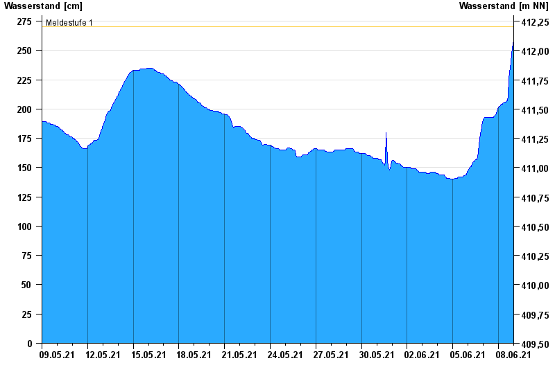
- Meldestufe 1 270 cm
- Meldestufe 2 310 cm
- Meldestufe 3 360 cm
- Meldestufe 4 390 cm
- Hochwassergefahrenfläche HQ100 390 cm
| Datum | Wasserstand [cm] |
|---|---|
| 09.06.2021 00:45 | 262 |
| 09.06.2021 00:30 | 261 |
| 09.06.2021 00:15 | 261 |
| 09.06.2021 00:00 | 260 |
| 08.06.2021 23:45 | 258 |
| 08.06.2021 23:30 | 257 |
| 08.06.2021 23:15 | 256 |
© Bayerisches Landesamt für Umwelt 2024