
- Startseite >
- Flüsse >
- Wasserstand >
- Isar >
- Weg >
- Jahresgrafik

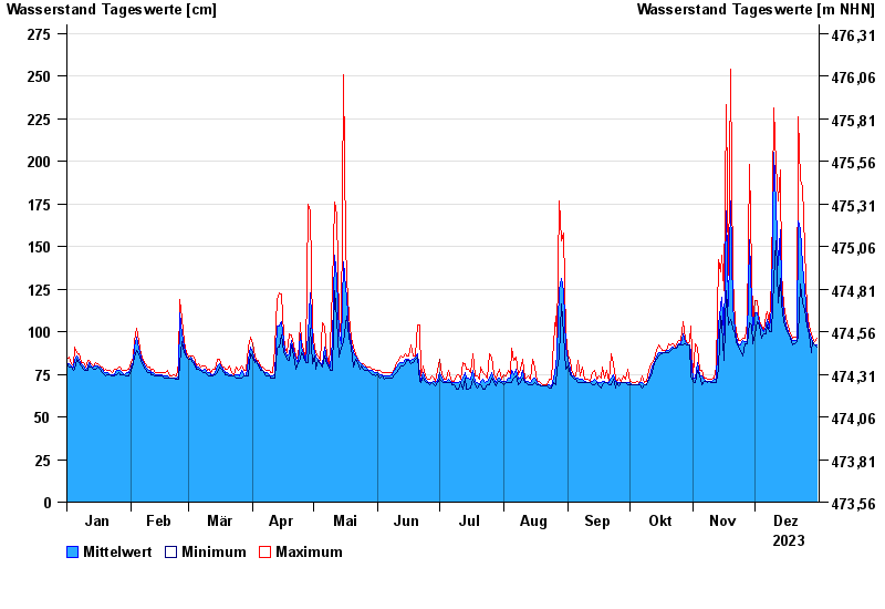
Jahresgrafik Weg / Isen
Wasserstand vom 01.01.2023 bis zum 31.12.2023
- 22.06.1975 Wasserstand: 375 cm
- 22.08.1977 Wasserstand: 355 cm
- 01.08.1991 Wasserstand: 332 cm
- 04.08.1973 Wasserstand: 332 cm
- 15.02.1990 Wasserstand: 330 cm
| Datum | Mittelwert [cm] | Maximum [cm] | Minimum [cm] |
|---|---|---|---|
| 31.12.2023 | 92 | 96 | 91 |
| 30.12.2023 | 92 | 94 | 92 |
| 29.12.2023 | 94 | 96 | 94 |
| 28.12.2023 | 96 | 99 | 88 |
| 27.12.2023 | 100 | 103 | 99 |
| 26.12.2023 | 107 | 113 | 103 |
| 25.12.2023 | 125 | 149 | 113 |
© Bayerisches Landesamt für Umwelt 2024