
- Startseite >
- Flüsse >
- Wasserstand >
- Isar >
- Wasserburg >
- Jahresgrafik

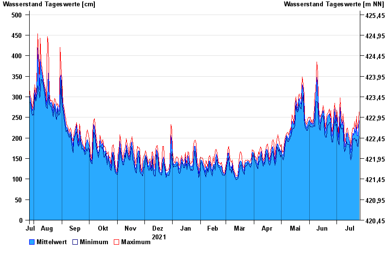
Jahresgrafik Wasserburg / Inn
Wasserstand vom 27.07.2021 bis zum 26.07.2022
- 23.08.2005 Wasserstand: 719 cm
- 07.08.1985 Wasserstand: 670 cm
- 21.05.1999 Wasserstand: 638 cm
- 02.06.2013 Wasserstand: 630 cm
- 20.07.1981 Wasserstand: 615 cm
| Datum | Mittelwert [cm] | Maximum [cm] | Minimum [cm] |
|---|---|---|---|
| 26.07.2022 | 242 | 263 | 204 |
| 25.07.2022 | 205 | 226 | 180 |
| 24.07.2022 | 206 | 223 | 181 |
| 23.07.2022 | 230 | 253 | 196 |
| 22.07.2022 | 211 | 223 | 193 |
| 21.07.2022 | 224 | 240 | 200 |
| 20.07.2022 | 207 | 222 | 197 |
© Bayerisches Landesamt für Umwelt 2024