
- Startseite >
- Flüsse >
- Wasserstand >
- Isar >
- Tutzing >
- Monatsgrafik

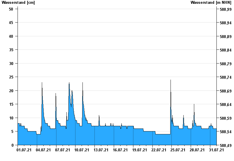
Monatsgrafik Tutzing / Kalkgraben
Wasserstand vom 01.07.2021 bis zum 31.07.2021
- 11.07.1989 Wasserstand: 107 cm
- 18.05.2002 Wasserstand: 70 cm
- 27.06.2009 Wasserstand: 69 cm
- 20.07.2004 Wasserstand: 64 cm
- 29.05.2007 Wasserstand: 60 cm
| Datum | Wasserstand [cm] |
|---|---|
| 01.08.2021 00:45 | 6 |
| 01.08.2021 00:30 | 6 |
| 01.08.2021 00:15 | 6 |
| 01.08.2021 00:00 | 6 |
| 31.07.2021 23:45 | 6 |
| 31.07.2021 23:30 | 6 |
| 31.07.2021 23:15 | 6 |
© Bayerisches Landesamt für Umwelt 2024