
- Startseite >
- Flüsse >
- Wasserstand >
- Isar >
- Stein bei Altenmarkt >
- Jahresgrafik

Jahresgrafik Stein bei Altenmarkt / Traun
Wasserstand vom 31.05.2020 bis zum 30.05.2021
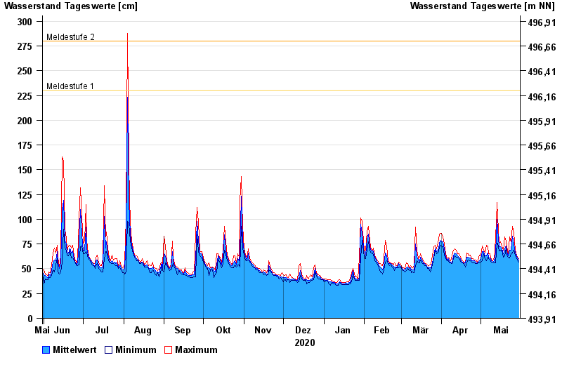
- Meldestufe 1 230 cm
- Meldestufe 2 280 cm
- Meldestufe 3 320 cm
- Meldestufe 4 370 cm
- Hochwassergefahrenfläche HQ100 360 cm
| Datum | Mittelwert [cm] | Maximum [cm] | Minimum [cm] |
|---|---|---|---|
| 30.05.2021 | 59 | 60 | 57 |
| 29.05.2021 | 61 | 62 | 59 |
| 28.05.2021 | 65 | 66 | 62 |
| 27.05.2021 | 66 | 69 | 64 |
| 26.05.2021 | 75 | 86 | 69 |
| 25.05.2021 | 83 | 93 | 66 |
| 24.05.2021 | 69 | 77 | 65 |
© Bayerisches Landesamt für Umwelt 2024