
- Startseite >
- Flüsse >
- Wasserstand >
- Isar >
- Staudach >
- Jahresgrafik

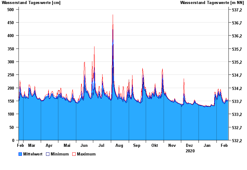
Jahresgrafik Staudach / Tiroler Achen
Wasserstand vom 22.02.2020 bis zum 21.02.2021
- 02.06.2013 Wasserstand: 675 cm
- 12.08.2002 Wasserstand: 577 cm
- 03.06.2010 Wasserstand: 571 cm
- 23.12.1991 Wasserstand: 564 cm
- 03.08.1991 Wasserstand: 532 cm
| Datum | Mittelwert [cm] | Maximum [cm] | Minimum [cm] |
|---|---|---|---|
| 21.02.2021 | 153 | 155 | 152 |
| 20.02.2021 | 151 | 153 | 150 |
| 19.02.2021 | 150 | 152 | 148 |
| 18.02.2021 | 155 | 161 | 151 |
| 17.02.2021 | 155 | 161 | 149 |
| 16.02.2021 | 146 | 150 | 143 |
| 15.02.2021 | 142 | 145 | 139 |
© Bayerisches Landesamt für Umwelt 2024