
- Startseite >
- Flüsse >
- Wasserstand >
- Isar >
- Staudach >
- Jahresgrafik

Jahresgrafik Staudach / Tiroler Achen
Wasserstand vom 04.02.2024 bis zum 03.02.2025
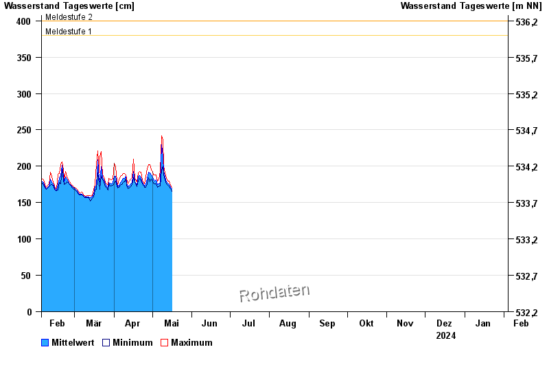
- Meldestufe 1 380 cm
- Meldestufe 2 400 cm
- Meldestufe 3 500 cm
- Meldestufe 4 550 cm
- Hochwassergefahrenfläche HQhäufig 510 cm
- Hochwassergefahrenfläche HQ100 650 cm
| Datum | Mittelwert [cm] | Maximum [cm] | Minimum [cm] |
|---|---|---|---|
| 06.06.2024 | 202 | 203 | 200 |
| 05.06.2024 | 212 | 225 | 202 |
| 04.06.2024 | 270 | 337 | 225 |
| 03.06.2024 | 243 | 323 | 209 |
| 02.06.2024 | 230 | 266 | 211 |
| 01.06.2024 | 268 | 331 | 206 |
| 31.05.2024 | 222 | 258 | 187 |
© Bayerisches Landesamt für Umwelt 2024