
- Startseite >
- Flüsse >
- Wasserstand >
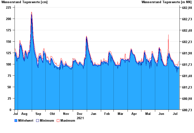
- Isar >
- Schmerold >
- Jahresgrafik

Jahresgrafik Schmerold / Mangfall
Wasserstand vom 25.07.2021 bis zum 24.07.2022
- 02.06.2013 Wasserstand: 358 cm
- 22.05.1999 Wasserstand: 322 cm
- 23.08.2005 Wasserstand: 316 cm
- 20.07.1981 Wasserstand: 299 cm
- 03.06.2010 Wasserstand: 268 cm
| Datum | Mittelwert [cm] | Maximum [cm] | Minimum [cm] |
|---|---|---|---|
| 24.07.2022 | 94 | 106 | 91 |
| 23.07.2022 | 94 | 105 | 90 |
| 22.07.2022 | 95 | 102 | 91 |
| 21.07.2022 | 93 | 96 | 89 |
| 20.07.2022 | 94 | 99 | 92 |
| 19.07.2022 | 94 | 99 | 82 |
| 18.07.2022 | 96 | 100 | 94 |
© Bayerisches Landesamt für Umwelt 2024