
- Startseite >
- Flüsse >
- Wasserstand >
- Isar >
- Rosenheim o.d. Mangfallmündung >
- Monatsgrafik

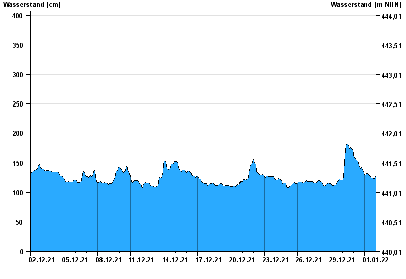
Monatsgrafik Rosenheim o.d. Mangfallmündung / Inn
Wasserstand vom 02.12.2021 bis zum 01.01.2022
- 23.08.2005 Wasserstand: 568 cm
- 07.08.1985 Wasserstand: 551 cm
- 21.05.1999 Wasserstand: 522 cm
- 02.06.2013 Wasserstand: 511 cm
- 20.07.1981 Wasserstand: 493 cm
| Datum | Wasserstand [cm] |
|---|---|
| 01.01.2022 23:45 | 128 |
| 01.01.2022 23:30 | 127 |
| 01.01.2022 23:15 | 127 |
| 01.01.2022 23:00 | 127 |
| 01.01.2022 22:45 | 127 |
| 01.01.2022 22:30 | 127 |
| 01.01.2022 22:15 | 126 |
© Bayerisches Landesamt für Umwelt 2024