
- Startseite >
- Flüsse >
- Wasserstand >
- Isar >
- Rosenheim o.d. Mangfallmündung >
- Jahresgrafik

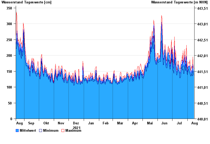
Jahresgrafik Rosenheim o.d. Mangfallmündung / Inn
Wasserstand vom 15.08.2021 bis zum 14.08.2022
- 23.08.2005 Wasserstand: 568 cm
- 07.08.1985 Wasserstand: 551 cm
- 21.05.1999 Wasserstand: 522 cm
- 02.06.2013 Wasserstand: 511 cm
- 20.07.1981 Wasserstand: 493 cm
| Datum | Mittelwert [cm] | Maximum [cm] | Minimum [cm] |
|---|---|---|---|
| 14.08.2022 | 149 | 159 | 137 |
| 13.08.2022 | 153 | 163 | 144 |
| 12.08.2022 | 172 | 195 | 152 |
| 11.08.2022 | 160 | 177 | 136 |
| 10.08.2022 | 145 | 158 | 136 |
| 09.08.2022 | 154 | 167 | 143 |
| 08.08.2022 | 144 | 152 | 135 |
© Bayerisches Landesamt für Umwelt 2024