
- Startseite >
- Flüsse >
- Wasserstand >
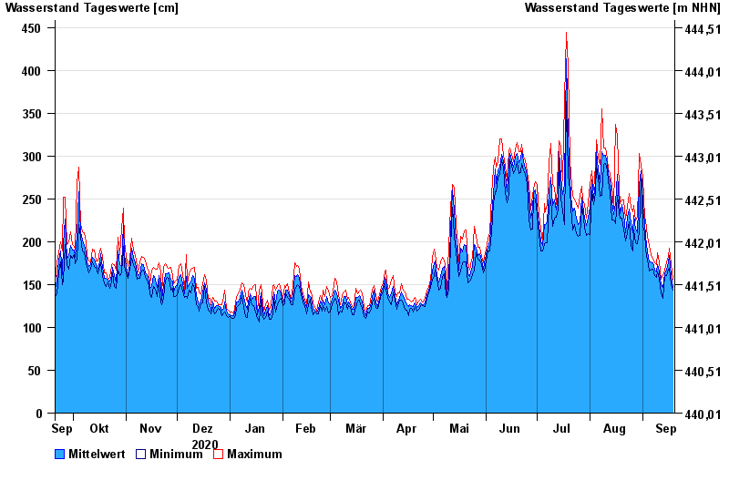
- Isar >
- Rosenheim o.d. Mangfallmündung >
- Jahresgrafik

Jahresgrafik Rosenheim o.d. Mangfallmündung / Inn
Wasserstand vom 20.09.2020 bis zum 19.09.2021
- 23.08.2005 Wasserstand: 568 cm
- 07.08.1985 Wasserstand: 551 cm
- 21.05.1999 Wasserstand: 522 cm
- 02.06.2013 Wasserstand: 511 cm
- 20.07.1981 Wasserstand: 493 cm
| Datum | Mittelwert [cm] | Maximum [cm] | Minimum [cm] |
|---|---|---|---|
| 19.09.2021 | 147 | 156 | 144 |
| 18.09.2021 | 161 | 174 | 150 |
| 17.09.2021 | 184 | 192 | 169 |
| 16.09.2021 | 177 | 183 | 168 |
| 15.09.2021 | 167 | 177 | 161 |
| 14.09.2021 | 163 | 167 | 159 |
| 13.09.2021 | 147 | 160 | 134 |
© Bayerisches Landesamt für Umwelt 2024