
- Startseite >
- Flüsse >
- Wasserstand >
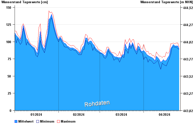
- Isar >
- Rosenheim >
- Jahresgrafik

Jahresgrafik Rosenheim / Mangfall
Wasserstand vom 01.01.2024 bis zum 26.04.2024
- 03.06.2013 Wasserstand: 494 cm
- 04.08.2020 Wasserstand: 438 cm
- 18.06.1979 Wasserstand: 403 cm
- 22.05.1999 Wasserstand: 402 cm
- 23.08.2005 Wasserstand: 383 cm
| Datum | Mittelwert [cm] | Maximum [cm] | Minimum [cm] |
|---|---|---|---|
| 26.04.2024 | 90 | 92 | 89 |
| 25.04.2024 | 94 | 98 | 90 |
| 24.04.2024 | 94 | 98 | 92 |
| 23.04.2024 | 94 | 97 | 92 |
| 22.04.2024 | 95 | 98 | 92 |
| 21.04.2024 | 92 | 96 | 90 |
| 20.04.2024 | 89 | 97 | 79 |
© Bayerisches Landesamt für Umwelt 2024