
- Startseite >
- Flüsse >
- Wasserstand >
- Isar >
- Raisting >
- Monatsgrafik

Monatsgrafik Raisting / Rott
Wasserstand vom 20.04.2024 bis zum 19.05.2024
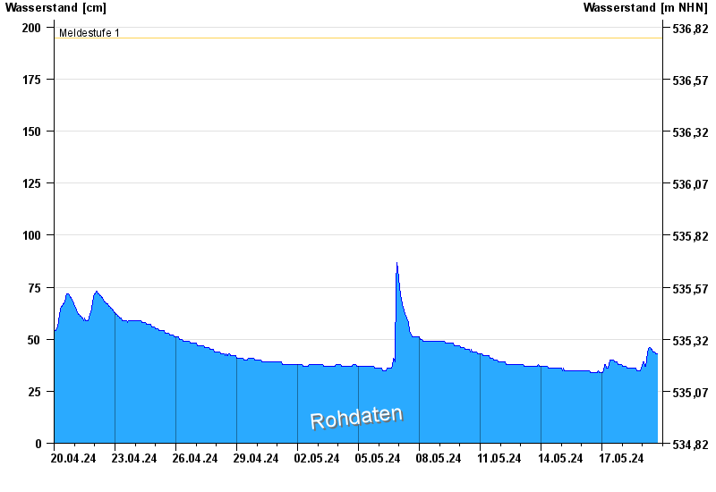
- Meldestufe 1 195 cm
- Meldestufe 2 210 cm
- Meldestufe 3 250 cm
- Meldestufe 4 290 cm
- Hochwassergefahrenfläche HQ100 340 cm
| Datum | Wasserstand [cm] |
|---|---|
| 02.05.2024 20:00 | 38 |
| 02.05.2024 19:45 | 38 |
| 02.05.2024 19:30 | 38 |
| 02.05.2024 19:15 | 38 |
| 02.05.2024 19:00 | 38 |
| 02.05.2024 18:45 | 38 |
| 02.05.2024 18:30 | 38 |
© Bayerisches Landesamt für Umwelt 2024