
- Startseite >
- Flüsse >
- Wasserstand >
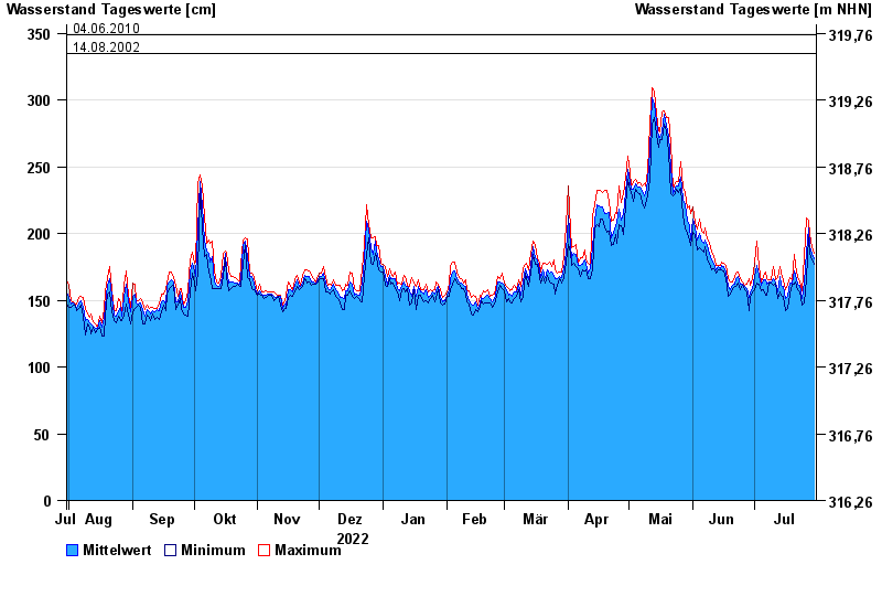
- Isar >
- Plattling >
- Jahresgrafik

Jahresgrafik Plattling / Isar
Wasserstand vom 31.07.2022 bis zum 30.07.2023
- 04.06.2013 Wasserstand: 400 cm
- 24.05.1999 Wasserstand: 378 cm
- 25.08.2005 Wasserstand: 374 cm
- 04.06.2010 Wasserstand: 349 cm
- 14.08.2002 Wasserstand: 335 cm
| Datum | Mittelwert [cm] | Maximum [cm] | Minimum [cm] |
|---|---|---|---|
| 30.07.2023 | 181 | 185 | 177 |
| 29.07.2023 | 185 | 190 | 180 |
| 28.07.2023 | 190 | 199 | 185 |
| 27.07.2023 | 204 | 210 | 198 |
| 26.07.2023 | 186 | 212 | 166 |
| 25.07.2023 | 164 | 183 | 148 |
| 24.07.2023 | 151 | 157 | 146 |
© Bayerisches Landesamt für Umwelt 2024