
- Startseite >
- Flüsse >
- Wasserstand >
- Isar >
- Plattling >
- Jahresgrafik

Jahresgrafik Plattling / Isar
Wasserstand vom 27.09.2020 bis zum 26.09.2021
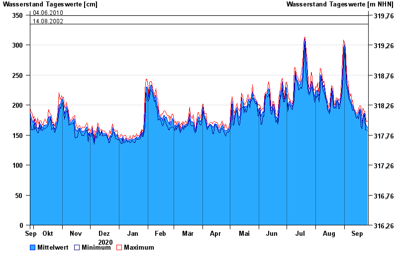
- 04.06.2013 Wasserstand: 400 cm
- 24.05.1999 Wasserstand: 378 cm
- 25.08.2005 Wasserstand: 374 cm
- 04.06.2010 Wasserstand: 349 cm
- 14.08.2002 Wasserstand: 335 cm
| Datum | Mittelwert [cm] | Maximum [cm] | Minimum [cm] |
|---|---|---|---|
| 26.09.2021 | 162 | 173 | 157 |
| 25.09.2021 | 165 | 172 | 159 |
| 24.09.2021 | 171 | 182 | 159 |
| 23.09.2021 | 185 | 189 | 178 |
| 22.09.2021 | 187 | 190 | 184 |
| 21.09.2021 | 182 | 195 | 174 |
| 20.09.2021 | 170 | 183 | 160 |
© Bayerisches Landesamt für Umwelt 2024