
- Startseite >
- Flüsse >
- Wasserstand >
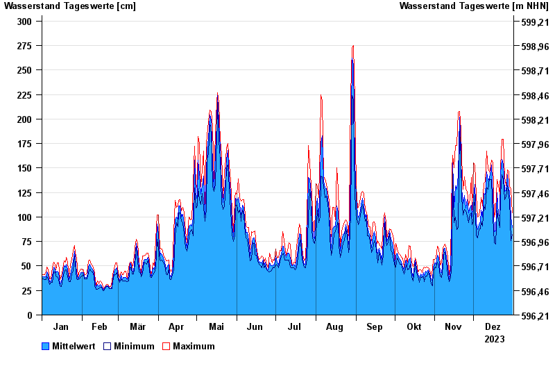
- Isar >
- Kochel >
- Jahresgrafik

Jahresgrafik Kochel / Loisach
Wasserstand vom 01.01.2023 bis zum 31.12.2023
- 24.08.2005 Wasserstand: 454 cm
- 23.05.1999 Wasserstand: 435 cm
- 11.08.1970 Wasserstand: 409 cm
- 21.07.1981 Wasserstand: 399 cm
- 03.06.2013 Wasserstand: 396 cm
| Datum | Mittelwert [cm] | Maximum [cm] | Minimum [cm] |
|---|---|---|---|
| 31.12.2023 | 89 | 104 | 82 |
| 30.12.2023 | 100 | 128 | 76 |
| 29.12.2023 | 127 | 131 | 118 |
| 28.12.2023 | 127 | 147 | 119 |
| 27.12.2023 | 143 | 148 | 132 |
| 26.12.2023 | 127 | 132 | 121 |
| 25.12.2023 | 126 | 140 | 118 |
© Bayerisches Landesamt für Umwelt 2024