
- Startseite >
- Flüsse >
- Wasserstand >
- Isar >
- Garmisch u. d. Partnachmündung >
- Aktuelle Messwerte

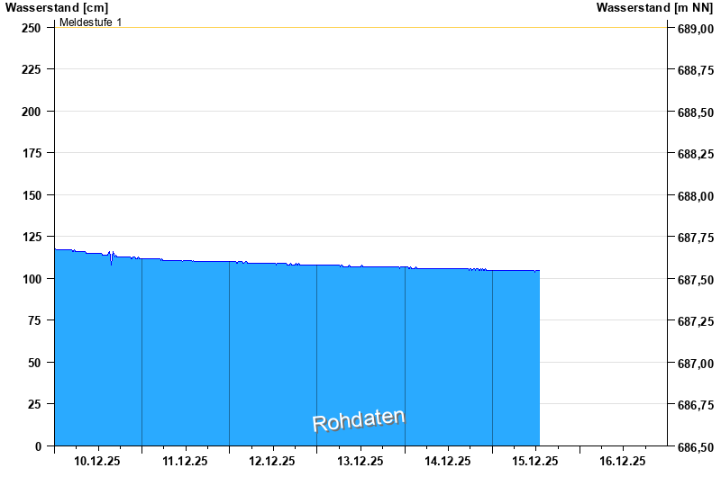
Aktuelle Messwerte Garmisch u. d. Partnachmündung / Loisach
Wasserstand vom 10.12.2025 bis zum 16.12.2025
Hinweis
Messwerte beeinflusst durch Kraftwerkssteuerung.
- Meldestufe 1 250 cm
- Meldestufe 2 280 cm
- Meldestufe 4 320 cm
- Hochwassergefahrenfläche HQ100 430 cm
- Hochwassergefahrenfläche HQhäufig 360 cm
| Datum | Wasserstand [cm] |
|---|---|
| 15.12.2025 22:00 | 104 |
| 15.12.2025 21:45 | 104 |
| 15.12.2025 21:30 | 104 |
| 15.12.2025 21:15 | 104 |
| 15.12.2025 21:00 | 104 |
| 15.12.2025 20:45 | 104 |
| 15.12.2025 20:30 | 104 |
© Bayerisches Landesamt für Umwelt 2025