
- Startseite >
- Flüsse >
- Wasserstand >
- Isar >
- Garmisch o. d. Partnachmündung >
- Gesamtzeitraum

Gesamtzeitraum Garmisch o. d. Partnachmündung / Loisach
Wasserstand vom 01.01.1962 bis zum 26.04.2024
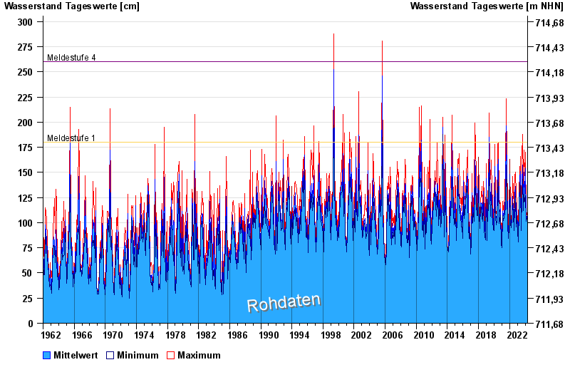
- Meldestufe 1 180 cm
- Meldestufe 4 260 cm
- Hochwassergefahrenfläche HQ100 330 cm
| Datum | Mittelwert [cm] | Maximum [cm] | Minimum [cm] |
|---|---|---|---|
| 26.04.2024 | 98 | 99 | 98 |
| 25.04.2024 | 98 | 99 | 97 |
| 24.04.2024 | 97 | 98 | 97 |
| 23.04.2024 | 98 | 98 | 97 |
| 22.04.2024 | 98 | 99 | 98 |
| 21.04.2024 | 99 | 100 | 99 |
| 20.04.2024 | 100 | 101 | 99 |
© Bayerisches Landesamt für Umwelt 2024