
- Startseite >
- Flüsse >
- Wasserstand >
- Isar >
- Eschelbach >
- Monatsgrafik

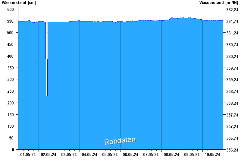
Monatsgrafik Eschelbach / Inn
Wasserstand vom 01.05.2024 bis zum 10.05.2024
- Hochwassergefahrenfläche HQ100 710 cm
| Datum | Wasserstand [cm] |
|---|---|
| 10.05.2024 11:30 | 551 |
| 10.05.2024 11:15 | 550 |
| 10.05.2024 11:00 | 550 |
| 10.05.2024 10:45 | 552 |
| 10.05.2024 10:30 | 551 |
| 10.05.2024 10:15 | 553 |
| 10.05.2024 10:00 | 553 |
© Bayerisches Landesamt für Umwelt 2024