
- Startseite >
- Flüsse >
- Wasserstand >
- Isar >
- Baierbrunn >
- Jahresgrafik

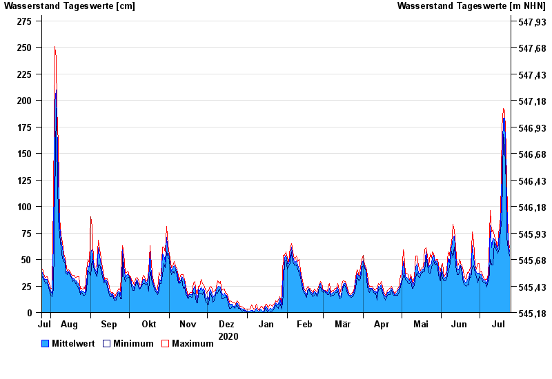
Jahresgrafik Baierbrunn / Isar
Wasserstand vom 25.07.2020 bis zum 24.07.2021
- 24.08.2005 Wasserstand: 361 cm
- 22.05.1999 Wasserstand: 331 cm
- 03.06.2013 Wasserstand: 307 cm
- 18.06.1979 Wasserstand: 291 cm
- 20.07.1981 Wasserstand: 285 cm
| Datum | Mittelwert [cm] | Maximum [cm] | Minimum [cm] |
|---|---|---|---|
| 24.07.2021 | 57 | 61 | 53 |
| 23.07.2021 | 65 | 70 | 60 |
| 22.07.2021 | 104 | 122 | 70 |
| 21.07.2021 | 132 | 155 | 122 |
| 20.07.2021 | 183 | 190 | 155 |
| 19.07.2021 | 183 | 192 | 168 |
| 18.07.2021 | 135 | 174 | 89 |
© Bayerisches Landesamt für Umwelt 2024