
- Startseite >
- Flüsse >
- Wasserstand >
- Isar >
- Aßling >
- Jahresgrafik

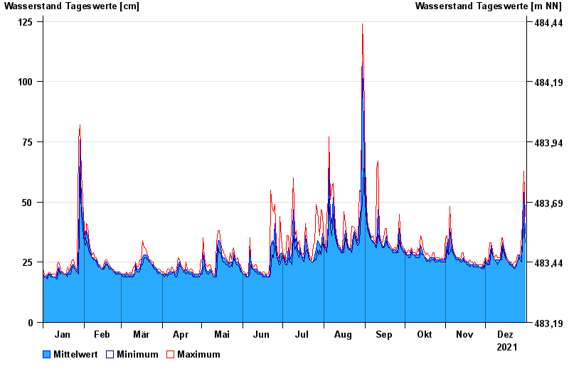
Jahresgrafik Aßling / Attel
Wasserstand vom 01.01.2021 bis zum 31.12.2021
- 02.08.1991 Wasserstand: 188 cm
- 04.08.2020 Wasserstand: 183 cm
- 02.06.2013 Wasserstand: 174 cm
- 21.05.1999 Wasserstand: 169 cm
- 15.02.1990 Wasserstand: 155 cm
| Datum | Mittelwert [cm] | Maximum [cm] | Minimum [cm] |
|---|---|---|---|
| 31.12.2021 | 37 | 44 | 33 |
| 30.12.2021 | 54 | 63 | 41 |
| 29.12.2021 | 35 | 41 | 33 |
| 28.12.2021 | 28 | 36 | 25 |
| 27.12.2021 | 27 | 28 | 26 |
| 26.12.2021 | 28 | 28 | 27 |
| 25.12.2021 | 25 | 28 | 25 |
© Bayerisches Landesamt für Umwelt 2024