
- Startseite >
- Flüsse >
- Wasserstand >
- Inn >
- Weg >
- Jahresgrafik

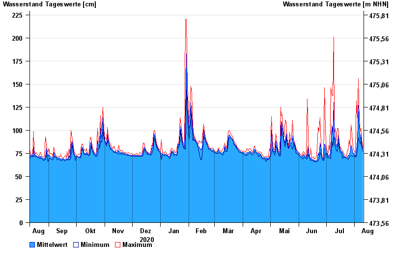
Jahresgrafik Weg / Isen
Wasserstand vom 11.08.2020 bis zum 10.08.2021
- 22.06.1975 Wasserstand: 375 cm
- 22.08.1977 Wasserstand: 355 cm
- 01.08.1991 Wasserstand: 332 cm
- 04.08.1973 Wasserstand: 332 cm
- 15.02.1990 Wasserstand: 330 cm
| Datum | Mittelwert [cm] | Maximum [cm] | Minimum [cm] |
|---|---|---|---|
| 10.08.2021 | 80 | 82 | 77 |
| 09.08.2021 | 85 | 90 | 82 |
| 08.08.2021 | 95 | 102 | 89 |
| 07.08.2021 | 90 | 99 | 85 |
| 06.08.2021 | 100 | 111 | 89 |
| 05.08.2021 | 127 | 156 | 92 |
| 04.08.2021 | 89 | 114 | 79 |
© Bayerisches Landesamt für Umwelt 2024