
- Startseite >
- Flüsse >
- Wasserstand >
- Inn >
- Weg >
- Jahresgrafik

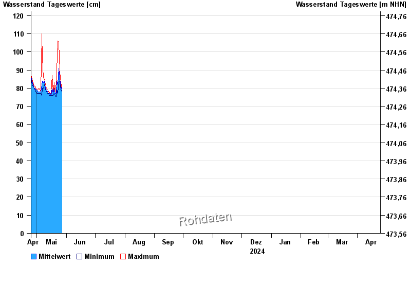
Jahresgrafik Weg / Isen
Wasserstand vom 25.04.2024 bis zum 24.04.2025
- 22.06.1975 Wasserstand: 375 cm
- 22.08.1977 Wasserstand: 355 cm
- 01.08.1991 Wasserstand: 332 cm
- 04.08.1973 Wasserstand: 332 cm
- 15.02.1990 Wasserstand: 330 cm
| Datum | Mittelwert [cm] | Maximum [cm] | Minimum [cm] |
|---|---|---|---|
| 06.05.2024 | 77 | 78 | 76 |
| 05.05.2024 | 78 | 78 | 77 |
| 04.05.2024 | 78 | 79 | 77 |
| 03.05.2024 | 78 | 80 | 77 |
| 02.05.2024 | 78 | 79 | 77 |
| 01.05.2024 | 79 | 79 | 77 |
| 30.04.2024 | 79 | 80 | 78 |
© Bayerisches Landesamt für Umwelt 2024