
- Startseite >
- Flüsse >
- Wasserstand >
- Inn >
- Trostberg >
- Jahresgrafik

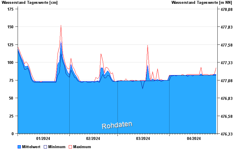
Jahresgrafik Trostberg / Alz
Wasserstand vom 01.01.2024 bis zum 29.04.2024
- 12.08.2002 Wasserstand: 490 cm
- 02.06.2013 Wasserstand: 481 cm
- 03.08.1991 Wasserstand: 423 cm
- 26.06.1995 Wasserstand: 401 cm
- 20.07.1981 Wasserstand: 396 cm
| Datum | Mittelwert [cm] | Maximum [cm] | Minimum [cm] |
|---|---|---|---|
| 29.04.2024 | 84 | 92 | 82 |
| 28.04.2024 | 83 | 83 | 82 |
| 27.04.2024 | 82 | 83 | 82 |
| 26.04.2024 | 82 | 83 | 82 |
| 25.04.2024 | 82 | 82 | 82 |
| 24.04.2024 | 82 | 83 | 82 |
| 23.04.2024 | 82 | 83 | 82 |
© Bayerisches Landesamt für Umwelt 2024