
- Startseite >
- Flüsse >
- Wasserstand >
- Inn >
- Staudach >
- Jahresgrafik

Jahresgrafik Staudach / Tiroler Achen
Wasserstand vom 25.07.2023 bis zum 24.07.2024
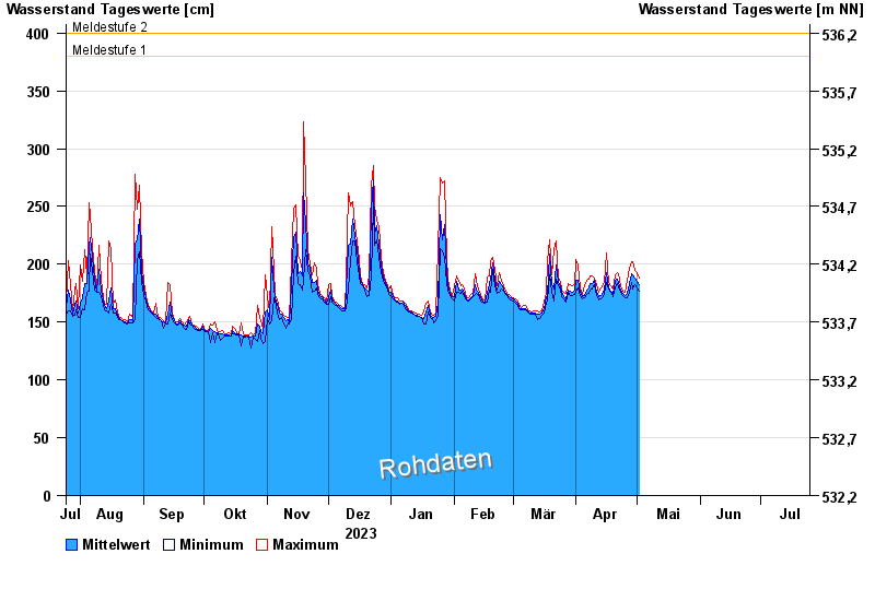
- Meldestufe 1 380 cm
- Meldestufe 2 400 cm
- Meldestufe 3 500 cm
- Meldestufe 4 550 cm
- Hochwassergefahrenfläche HQhäufig 510 cm
- Hochwassergefahrenfläche HQ100 650 cm
| Datum | Mittelwert [cm] | Maximum [cm] | Minimum [cm] |
|---|---|---|---|
| 16.05.2024 | 170 | 171 | 169 |
| 15.05.2024 | 171 | 174 | 169 |
| 14.05.2024 | 175 | 180 | 172 |
| 13.05.2024 | 177 | 180 | 174 |
| 12.05.2024 | 179 | 183 | 176 |
| 11.05.2024 | 185 | 191 | 181 |
| 10.05.2024 | 193 | 200 | 188 |
© Bayerisches Landesamt für Umwelt 2024