
- Startseite >
- Flüsse >
- Wasserstand >
- Inn >
- Staudach >
- Jahresgrafik

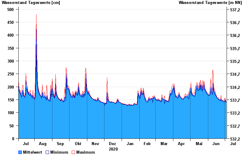
Jahresgrafik Staudach / Tiroler Achen
Wasserstand vom 04.07.2020 bis zum 03.07.2021
- 02.06.2013 Wasserstand: 675 cm
- 12.08.2002 Wasserstand: 577 cm
- 03.06.2010 Wasserstand: 571 cm
- 23.12.1991 Wasserstand: 564 cm
- 03.08.1991 Wasserstand: 532 cm
| Datum | Mittelwert [cm] | Maximum [cm] | Minimum [cm] |
|---|---|---|---|
| 03.07.2021 | 141 | 142 | 140 |
| 02.07.2021 | 145 | 149 | 142 |
| 01.07.2021 | 150 | 157 | 147 |
| 30.06.2021 | 143 | 152 | 142 |
| 29.06.2021 | 143 | 146 | 141 |
| 28.06.2021 | 145 | 149 | 142 |
| 27.06.2021 | 146 | 148 | 143 |
© Bayerisches Landesamt für Umwelt 2024