
- Startseite >
- Flüsse >
- Wasserstand >
- Inn >
- Staudach >
- Gesamtzeitraum

Gesamtzeitraum Staudach / Tiroler Achen
Wasserstand vom 01.11.1969 bis zum 09.05.2024
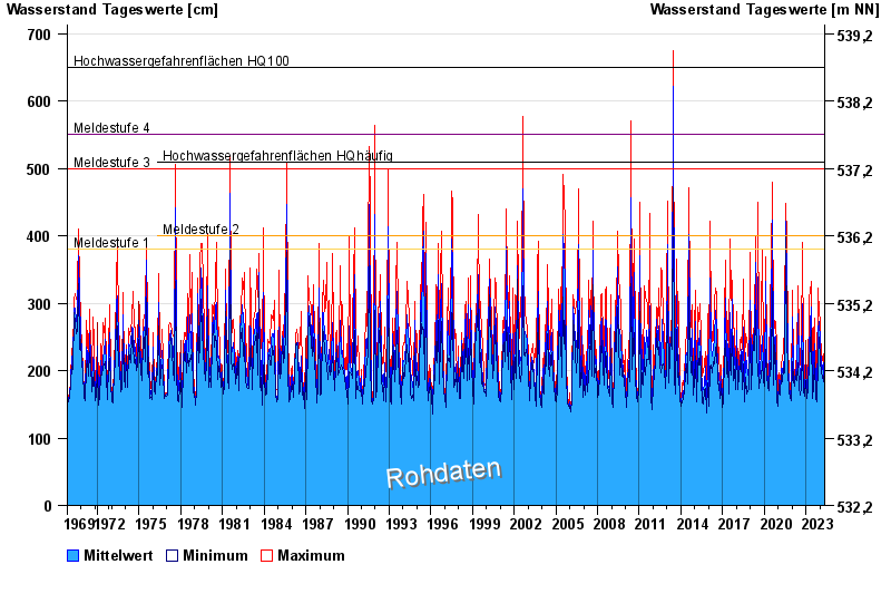
- Meldestufe 1 380 cm
- Meldestufe 2 400 cm
- Meldestufe 3 500 cm
- Meldestufe 4 550 cm
- Hochwassergefahrenfläche HQhäufig 510 cm
- Hochwassergefahrenfläche HQ100 650 cm
| Datum | Mittelwert [cm] | Maximum [cm] | Minimum [cm] |
|---|---|---|---|
| 09.05.2024 | 233 | 236 | 230 |
| 08.05.2024 | 230 | 242 | 195 |
| 07.05.2024 | 177 | 193 | 173 |
| 06.05.2024 | 176 | 182 | 172 |
| 05.05.2024 | 175 | 180 | 171 |
| 04.05.2024 | 181 | 188 | 176 |
| 03.05.2024 | 180 | 188 | 176 |
© Bayerisches Landesamt für Umwelt 2024