
- Startseite >
- Flüsse >
- Wasserstand >
- Inn >
- Rottersdorf >
- Monatsgrafik

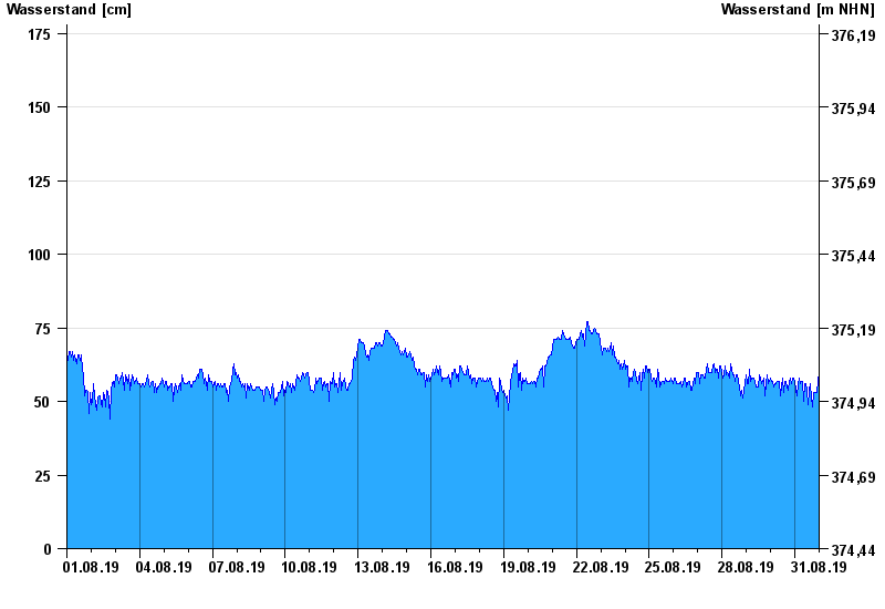
Monatsgrafik Rottersdorf / Vils
Wasserstand vom 01.08.2019 bis zum 31.08.2019
- 190 cm: Rottersdorf: Ausuferungen von Reisbach bis Rottersdorf (Vils I)
- 200 cm: Rottersdorf: Ausuferungen von Rottersdorf bis Lappersdorf im südlichen Talbereich (Vils II)
| Datum | Wasserstand [cm] |
|---|---|
| 01.09.2019 00:45 | 58 |
| 01.09.2019 00:30 | 59 |
| 01.09.2019 00:15 | 59 |
| 01.09.2019 00:00 | 59 |
| 31.08.2019 23:45 | 60 |
| 31.08.2019 23:30 | 60 |
| 31.08.2019 23:15 | 57 |
© Bayerisches Landesamt für Umwelt 2024