
- Startseite >
- Flüsse >
- Wasserstand >
- Inn >
- Rottersdorf >
- Jahresgrafik

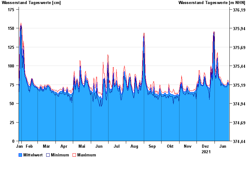
Jahresgrafik Rottersdorf / Vils
Wasserstand vom 27.01.2021 bis zum 26.01.2022
- 03.06.2013 Wasserstand: 280 cm
- 21.02.1999 Wasserstand: 255 cm
- 04.08.1991 Wasserstand: 252 cm
- 31.03.2000 Wasserstand: 226 cm
- 14.04.1994 Wasserstand: 226 cm
| Datum | Mittelwert [cm] | Maximum [cm] | Minimum [cm] |
|---|---|---|---|
| 26.01.2022 | 75 | 78 | 74 |
| 25.01.2022 | 78 | 80 | 76 |
| 24.01.2022 | 78 | 81 | 77 |
| 23.01.2022 | 76 | 78 | 75 |
| 22.01.2022 | 74 | 76 | 72 |
| 21.01.2022 | 73 | 75 | 72 |
| 20.01.2022 | 73 | 75 | 72 |
© Bayerisches Landesamt für Umwelt 2024