
- Startseite >
- Flüsse >
- Wasserstand >
- Inn >
- Mühldorf >
- Monatsgrafik

Monatsgrafik Mühldorf / Inn
Wasserstand vom 18.02.2021 bis zum 17.03.2021
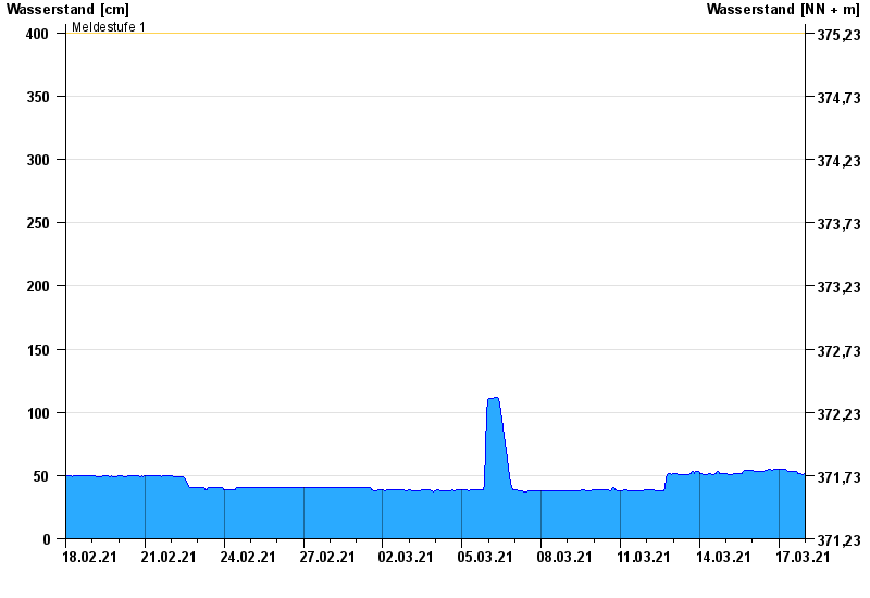
- Meldestufe 1 400 cm
- Hochwassergefahrenfläche HQ100 800 cm
| Datum | Wasserstand [cm] |
|---|---|
| 17.03.2021 23:45 | 52 |
| 17.03.2021 23:30 | 52 |
| 17.03.2021 23:15 | 52 |
| 17.03.2021 23:00 | 52 |
| 17.03.2021 22:45 | 51 |
| 17.03.2021 22:30 | 51 |
| 17.03.2021 22:15 | 51 |
© Bayerisches Landesamt für Umwelt 2024