
- Startseite >
- Flüsse >
- Wasserstand >
- Inn >
- Gufflham >
- Jahresgrafik

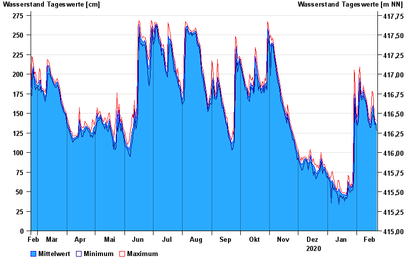
Jahresgrafik Gufflham / Alzkanal
Wasserstand vom 23.02.2020 bis zum 22.02.2021
 Für diesen Pegel sind keine Meldestufen hinterlegt.
| Datum | Mittelwert [cm] | Maximum [cm] | Minimum [cm] |
|---|---|---|---|
| 22.02.2021 | 136 | 141 | 128 |
| 21.02.2021 | 138 | 142 | 137 |
| 20.02.2021 | 141 | 143 | 136 |
| 19.02.2021 | 146 | 150 | 143 |
| 18.02.2021 | 160 | 176 | 149 |
| 17.02.2021 | 156 | 178 | 145 |
| 16.02.2021 | 138 | 153 | 132 |
© Bayerisches Landesamt für Umwelt 2024