
- Startseite >
- Flüsse >
- Wasserstand >
- Inn >
- Anger >
- Jahresgrafik

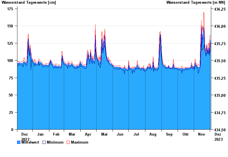
Jahresgrafik Anger / Attel
Wasserstand vom 03.12.2022 bis zum 02.12.2023
- 02.08.1991 Wasserstand: 293 cm
- 05.08.2020 Wasserstand: 262 cm
- 03.06.2013 Wasserstand: 262 cm
- 18.06.1979 Wasserstand: 258 cm
- 22.05.1999 Wasserstand: 252 cm
| Datum | Mittelwert [cm] | Maximum [cm] | Minimum [cm] |
|---|---|---|---|
| 02.12.2023 | 130 | 136 | 125 |
| 01.12.2023 | 118 | 136 | 108 |
| 30.11.2023 | 110 | 114 | 108 |
| 29.11.2023 | 119 | 125 | 114 |
| 28.11.2023 | 115 | 125 | 109 |
| 27.11.2023 | 110 | 112 | 109 |
| 26.11.2023 | 113 | 116 | 111 |
© Bayerisches Landesamt für Umwelt 2024