
- Startseite >
- Flüsse >
- Wasserstand >
- Iller - Lech - Bodensee >
- Gunzesried >
- Monatsgrafik

Monatsgrafik Gunzesried / Gunzesrieder Ach
Wasserstand vom 18.01.2020 bis zum 17.02.2020
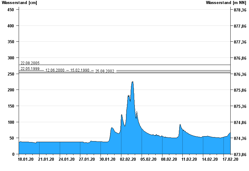
- 22.08.2005 Wasserstand: 278 cm
- 22.05.1999 Wasserstand: 260 cm
- 12.06.2000 Wasserstand: 255 cm
- 15.02.1990 Wasserstand: 255 cm
- 25.08.2002 Wasserstand: 253 cm
| Datum | Wasserstand [cm] |
|---|---|
| 17.02.2020 23:45 | 67 |
| 17.02.2020 23:30 | 67 |
| 17.02.2020 23:15 | 67 |
| 17.02.2020 23:00 | 67 |
| 17.02.2020 22:45 | 67 |
| 17.02.2020 22:30 | 67 |
| 17.02.2020 22:15 | 66 |
© Bayerisches Landesamt für Umwelt 2024