
- Startseite >
- Flüsse >
- Wasserstand >
- Oberer Main - Elbe >
- Unterlangenstadt >
- Monatsgrafik

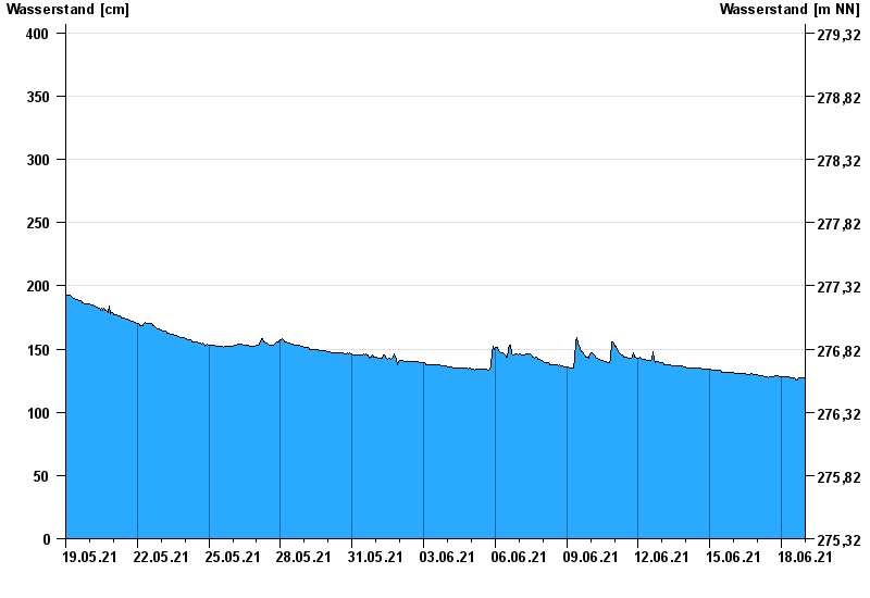
Monatsgrafik Unterlangenstadt / Rodach
Wasserstand vom 19.05.2021 bis zum 18.06.2021
- 28.01.1901 Wasserstand: 522 cm
- 02.03.1901 Wasserstand: 490 cm
- 24.12.1967 Wasserstand: 482 cm
- 06.04.1901 Wasserstand: 482 cm
- 09.02.1946 Wasserstand: 477 cm
| Datum | Wasserstand [cm] |
|---|---|
| 19.06.2021 00:45 | 127 |
| 19.06.2021 00:30 | 127 |
| 19.06.2021 00:15 | 127 |
| 19.06.2021 00:00 | 127 |
| 18.06.2021 23:45 | 127 |
| 18.06.2021 23:30 | 127 |
| 18.06.2021 23:15 | 127 |
© Bayerisches Landesamt für Umwelt 2024