
- Startseite >
- Flüsse >
- Wasserstand >
- Oberer Main - Elbe >
- Lichtenfels >
- Jahresgrafik

Jahresgrafik Lichtenfels / Main
Wasserstand vom 19.01.2022 bis zum 18.01.2023
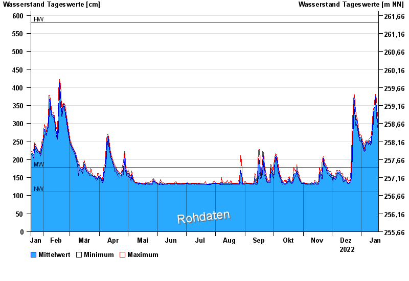
| Datum | Mittelwert [cm] | Maximum [cm] | Minimum [cm] |
|---|---|---|---|
| 18.01.2023 | 304 | 320 | 289 |
| 17.01.2023 | 345 | 368 | 321 |
| 16.01.2023 | 377 | 381 | 369 |
| 15.01.2023 | 349 | 373 | 335 |
| 14.01.2023 | 341 | 345 | 333 |
| 13.01.2023 | 310 | 333 | 285 |
| 12.01.2023 | 272 | 285 | 261 |
© Bayerisches Landesamt für Umwelt 2024