
- Startseite >
- Flüsse >
- Wasserstand >
- Oberer Main - Elbe >
- Kemmern >
- Jahresgrafik

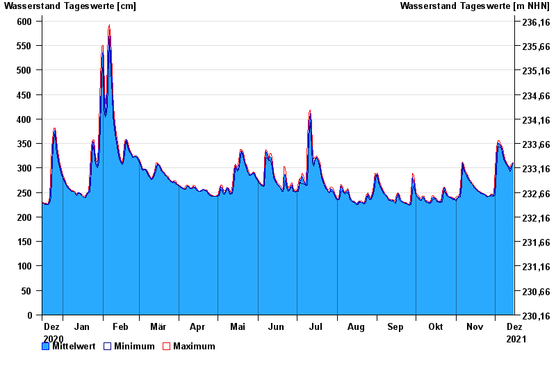
Jahresgrafik Kemmern / Main
Wasserstand vom 16.12.2020 bis zum 15.12.2021
- 04.01.2003 Wasserstand: 704 cm
- 25.12.1967 Wasserstand: 700 cm
- 07.01.1982 Wasserstand: 689 cm
- 15.01.2011 Wasserstand: 688 cm
- 29.01.2002 Wasserstand: 681 cm
| Datum | Mittelwert [cm] | Maximum [cm] | Minimum [cm] |
|---|---|---|---|
| 15.12.2021 | 310 | 311 | 309 |
| 14.12.2021 | 306 | 309 | 303 |
| 13.12.2021 | 299 | 303 | 293 |
| 12.12.2021 | 297 | 301 | 293 |
| 11.12.2021 | 304 | 305 | 301 |
| 10.12.2021 | 307 | 309 | 305 |
| 09.12.2021 | 312 | 315 | 309 |
© Bayerisches Landesamt für Umwelt 2024