
- Startseite >
- Flüsse >
- Wasserstand >
- Oberer Main - Elbe >
- Haslach Werksabfluss >
- Jahresgrafik

Jahresgrafik Haslach Werksabfluss / Wertach
Wasserstand vom 25.02.2020 bis zum 24.02.2021
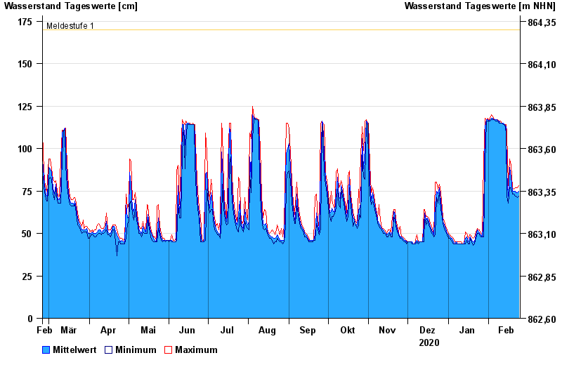
- Meldestufe 1 170 cm
- Meldestufe 2 200 cm
- Meldestufe 3 250 cm
- Meldestufe 4 300 cm
- Hochwassergefahrenfläche HQ100 250 cm
| Datum | Mittelwert [cm] | Maximum [cm] | Minimum [cm] |
|---|---|---|---|
| 24.02.2021 | 75 | 78 | 72 |
| 23.02.2021 | 74 | 77 | 71 |
| 22.02.2021 | 74 | 77 | 72 |
| 21.02.2021 | 75 | 77 | 72 |
| 20.02.2021 | 75 | 76 | 73 |
| 19.02.2021 | 75 | 77 | 73 |
| 18.02.2021 | 83 | 90 | 77 |
© Bayerisches Landesamt für Umwelt 2024