
- Startseite >
- Flüsse >
- Wasserstand >
- Oberer Main - Elbe >
- Bayreuth >
- Monatsgrafik

Monatsgrafik Bayreuth / Roter Main
Wasserstand vom 20.05.2022 bis zum 19.06.2022
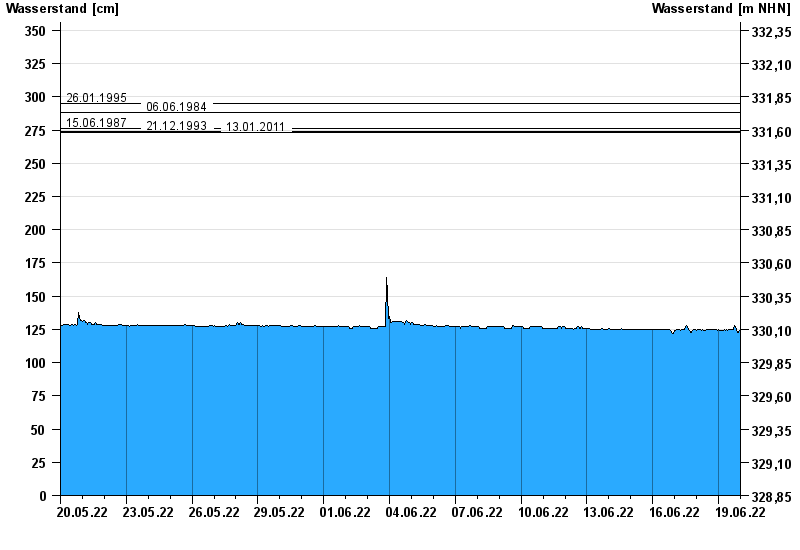
- 26.01.1995 Wasserstand: 295 cm
- 06.06.1984 Wasserstand: 288 cm
- 15.06.1987 Wasserstand: 276 cm
- 21.12.1993 Wasserstand: 274 cm
- 13.01.2011 Wasserstand: 273 cm
| Datum | Wasserstand [cm] |
|---|---|
| 20.06.2022 00:45 | 124 |
| 20.06.2022 00:30 | 124 |
| 20.06.2022 00:15 | 123 |
| 20.06.2022 00:00 | 123 |
| 19.06.2022 23:45 | 124 |
| 19.06.2022 23:30 | 124 |
| 19.06.2022 23:15 | 124 |
© Bayerisches Landesamt für Umwelt 2024