
- Startseite >
- Flüsse >
- Wasserstand >
- Bayern >
- Trunstadt >
- Monatsgrafik

Monatsgrafik Trunstadt / Main
Wasserstand vom 01.04.2024 bis zum 26.04.2024
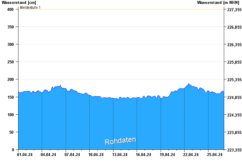
- Meldestufe 1 400 cm
- Meldestufe 2 450 cm
- Meldestufe 3 600 cm
- Meldestufe 4 700 cm
- Hochwassergefahrenfläche HQ100 790 cm
| Datum | Wasserstand [cm] |
|---|---|
| 26.04.2024 19:00 | 166 |
| 26.04.2024 18:45 | 166 |
| 26.04.2024 18:30 | 166 |
| 26.04.2024 18:15 | 166 |
| 26.04.2024 18:00 | 166 |
| 26.04.2024 17:45 | 166 |
| 26.04.2024 17:30 | 165 |
© Bayerisches Landesamt für Umwelt 2024