
- Startseite >
- Flüsse >
- Wasserstand >
- Bayern >
- Thann >
- Jahresgrafik

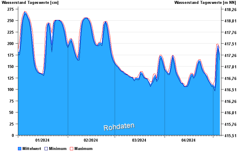
Jahresgrafik Thann / Altmühl
Wasserstand vom 01.01.2024 bis zum 05.05.2024
- 01.06.2013 Wasserstand: 335 cm
- 29.10.1998 Wasserstand: 327 cm
- 21.12.1993 Wasserstand: 324 cm
- 08.01.2011 Wasserstand: 323 cm
- 17.06.2007 Wasserstand: 320 cm
| Datum | Mittelwert [cm] | Maximum [cm] | Minimum [cm] |
|---|---|---|---|
| 05.05.2024 | 180 | 189 | 169 |
| 04.05.2024 | 196 | 199 | 189 |
| 03.05.2024 | 175 | 198 | 122 |
| 02.05.2024 | 104 | 121 | 96 |
| 01.05.2024 | 109 | 110 | 106 |
| 30.04.2024 | 110 | 113 | 106 |
| 29.04.2024 | 115 | 118 | 113 |
© Bayerisches Landesamt für Umwelt 2024