
- Startseite >
- Flüsse >
- Wasserstand >
- Bayern >
- Teisnach >
- Jahresgrafik

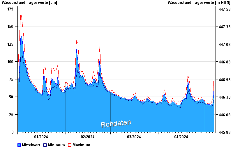
Jahresgrafik Teisnach / Schwarzer Regen
Wasserstand vom 01.01.2024 bis zum 07.05.2024
- 13.08.2002 Wasserstand: 273 cm
- 13.01.1920 Wasserstand: 257 cm
- 07.01.1993 Wasserstand: 250 cm
- 14.03.1940 Wasserstand: 248 cm
- 01.01.1941 Wasserstand: 243 cm
| Datum | Mittelwert [cm] | Maximum [cm] | Minimum [cm] |
|---|---|---|---|
| 07.05.2024 | 68 | 83 | 49 |
| 06.05.2024 | 40 | 48 | 38 |
| 05.05.2024 | 38 | 40 | 36 |
| 04.05.2024 | 39 | 40 | 38 |
| 03.05.2024 | 39 | 40 | 38 |
| 02.05.2024 | 40 | 41 | 38 |
| 01.05.2024 | 42 | 44 | 40 |
© Bayerisches Landesamt für Umwelt 2024