
- Startseite >
- Flüsse >
- Wasserstand >
- Bayern >
- Passau Ingling >
- Jahresgrafik

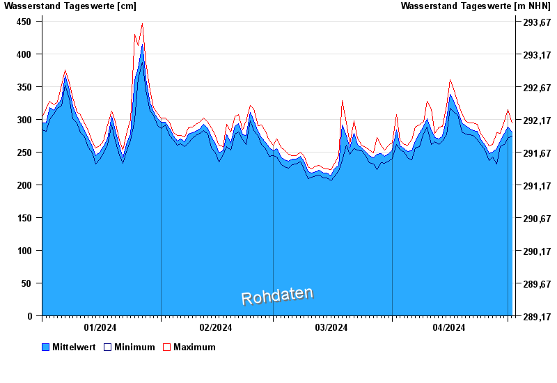
Jahresgrafik Passau Ingling / Inn
Wasserstand vom 01.01.2024 bis zum 02.05.2024
- Hochwassergefahrenfläche HQ100 1140 cm
| Datum | Mittelwert [cm] | Maximum [cm] | Minimum [cm] |
|---|---|---|---|
| 02.05.2024 | 281 | 294 | 274 |
| 01.05.2024 | 288 | 315 | 271 |
| 30.04.2024 | 278 | 298 | 261 |
| 29.04.2024 | 267 | 279 | 258 |
| 28.04.2024 | 255 | 280 | 232 |
| 27.04.2024 | 250 | 261 | 242 |
| 26.04.2024 | 248 | 259 | 237 |
© Bayerisches Landesamt für Umwelt 2024