
- Startseite >
- Flüsse >
- Wasserstand >
- Bayern >
- Ösbühl >
- Monatsgrafik

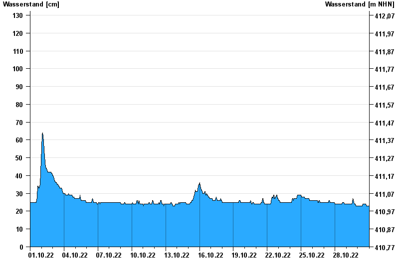
Monatsgrafik Ösbühl / Danglesbach
Wasserstand vom 01.10.2022 bis zum 30.10.2022
Überspannungsschaden
Datenausfall durch Überspannung / Gewitter
Reparatur in Arbeit
- 21.12.1993 Wasserstand: 175 cm
- 01.11.1998 Wasserstand: 174 cm
- 26.01.1995 Wasserstand: 174 cm
- 26.02.1997 Wasserstand: 167 cm
- 10.06.2013 Wasserstand: 163 cm
| Datum | Wasserstand [cm] |
|---|---|
| 30.10.2022 23:45 | 23 |
| 30.10.2022 23:30 | 23 |
| 30.10.2022 23:15 | 23 |
| 30.10.2022 23:00 | 23 |
| 30.10.2022 22:45 | 23 |
| 30.10.2022 22:30 | 23 |
| 30.10.2022 22:15 | 23 |
© Bayerisches Landesamt für Umwelt 2024