
- Startseite >
- Flüsse >
- Wasserstand >
- Bayern >
- Oberstdorf >
- Monatsgrafik

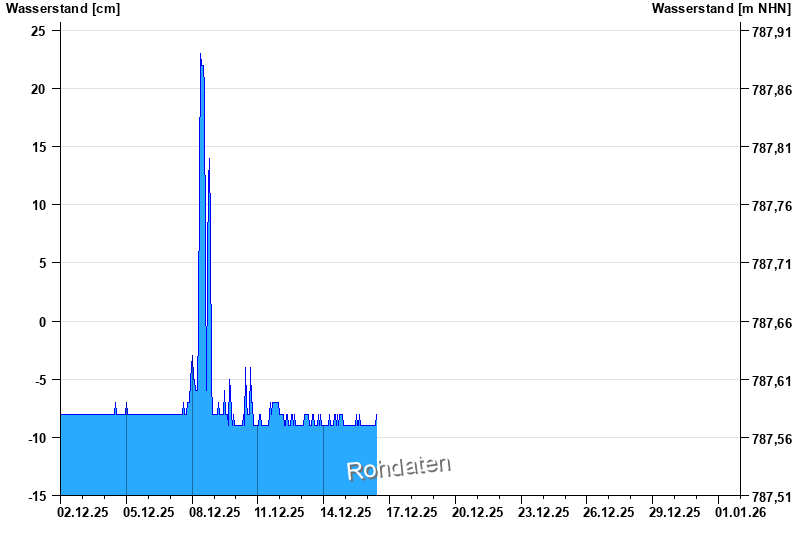
Monatsgrafik Oberstdorf / Trettach
Wasserstand vom 02.12.2025 bis zum 01.01.2026
Messwerte
Nach Baumaßnahme noch instabiles Querprofil. Wasserstand zeitweise < 0cm.
- Hochwassergefahrenfläche HQhäufig 180 cm
| Datum | Wasserstand [cm] |
|---|---|
| 16.12.2025 05:00 | -9 |
| 16.12.2025 04:45 | -9 |
| 16.12.2025 04:30 | -9 |
| 16.12.2025 04:15 | -9 |
| 16.12.2025 04:00 | -9 |
| 16.12.2025 03:45 | -9 |
| 16.12.2025 03:30 | -9 |
© Bayerisches Landesamt für Umwelt 2025