
- Startseite >
- Flüsse >
- Wasserstand >
- Bayern >
- Mittenwald >
- Jahresgrafik

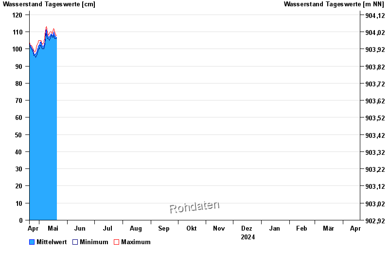
Jahresgrafik Mittenwald / Isar
Wasserstand vom 20.04.2024 bis zum 19.04.2025
- 280 cm: Mittenwald: Beginn der Ausuferung im Ort oberhalb der Karwendelbrücke links.
- 300 cm: Mittenwald: Überflutung landwirtschaftlicher Flächen
| Datum | Mittelwert [cm] | Maximum [cm] | Minimum [cm] |
|---|---|---|---|
| 03.05.2024 | 105 | 105 | 104 |
| 02.05.2024 | 104 | 105 | 102 |
| 01.05.2024 | 102 | 105 | 100 |
| 30.04.2024 | 102 | 105 | 100 |
| 29.04.2024 | 100 | 103 | 98 |
| 28.04.2024 | 98 | 102 | 96 |
| 27.04.2024 | 97 | 99 | 95 |
© Bayerisches Landesamt für Umwelt 2024