
- Startseite >
- Flüsse >
- Wasserstand >
- Bayern >
- Langenau >
- Jahresgrafik

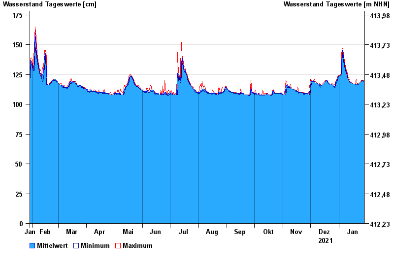
Jahresgrafik Langenau / Langenaubach
Wasserstand vom 29.01.2021 bis zum 28.01.2022
- 27.01.2002 Wasserstand: 183 cm
- 24.12.1967 Wasserstand: 182 cm
- 06.01.1982 Wasserstand: 178 cm
- 10.03.1981 Wasserstand: 177 cm
- 14.01.2011 Wasserstand: 176 cm
| Datum | Mittelwert [cm] | Maximum [cm] | Minimum [cm] |
|---|---|---|---|
| 28.01.2022 | 119 | 120 | 119 |
| 27.01.2022 | 120 | 120 | 120 |
| 26.01.2022 | 120 | 120 | 120 |
| 25.01.2022 | 119 | 120 | 119 |
| 24.01.2022 | 118 | 119 | 118 |
| 23.01.2022 | 118 | 118 | 118 |
| 22.01.2022 | 117 | 118 | 116 |
© Bayerisches Landesamt für Umwelt 2024