
- Startseite >
- Flüsse >
- Wasserstand >
- Bayern >
- Landau >
- Jahresgrafik

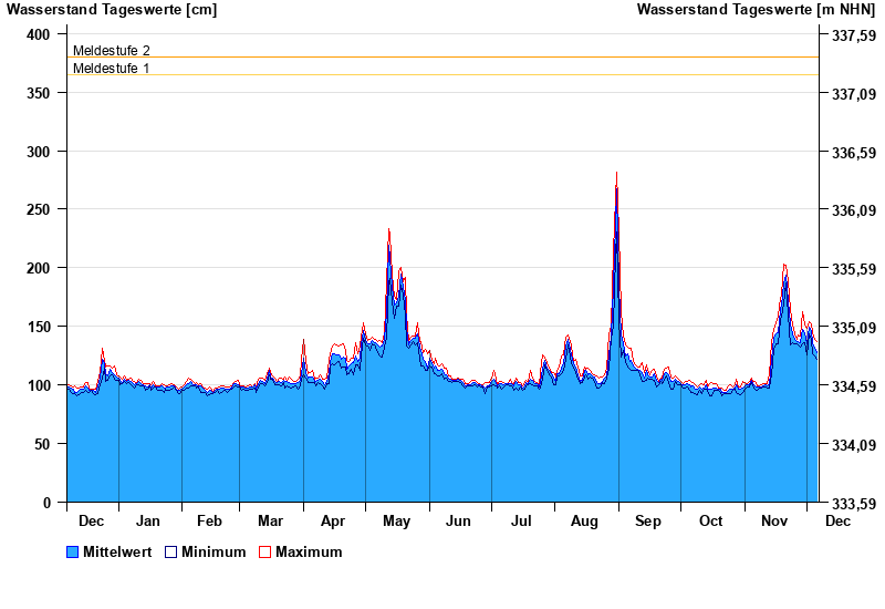
Jahresgrafik Landau / Isar
Wasserstand vom 07.12.2022 bis zum 06.12.2023
- Meldestufe 1 365 cm
- Meldestufe 2 380 cm
- Meldestufe 3 440 cm
- Meldestufe 4 500 cm
- Hochwassergefahrenfläche HQ100 520 cm
| Datum | Mittelwert [cm] | Maximum [cm] | Minimum [cm] |
|---|---|---|---|
| 06.12.2023 | 128 | 137 | 122 |
| 05.12.2023 | 131 | 139 | 125 |
| 04.12.2023 | 136 | 145 | 127 |
| 03.12.2023 | 146 | 152 | 139 |
| 02.12.2023 | 149 | 154 | 144 |
| 01.12.2023 | 135 | 148 | 126 |
| 30.11.2023 | 145 | 151 | 136 |
© Bayerisches Landesamt für Umwelt 2025