
- Startseite >
- Flüsse >
- Wasserstand >
- Bayern >
- Güntersthal >
- Jahresgrafik

Jahresgrafik Güntersthal / Pegnitz
Wasserstand vom 14.11.2023 bis zum 13.11.2024
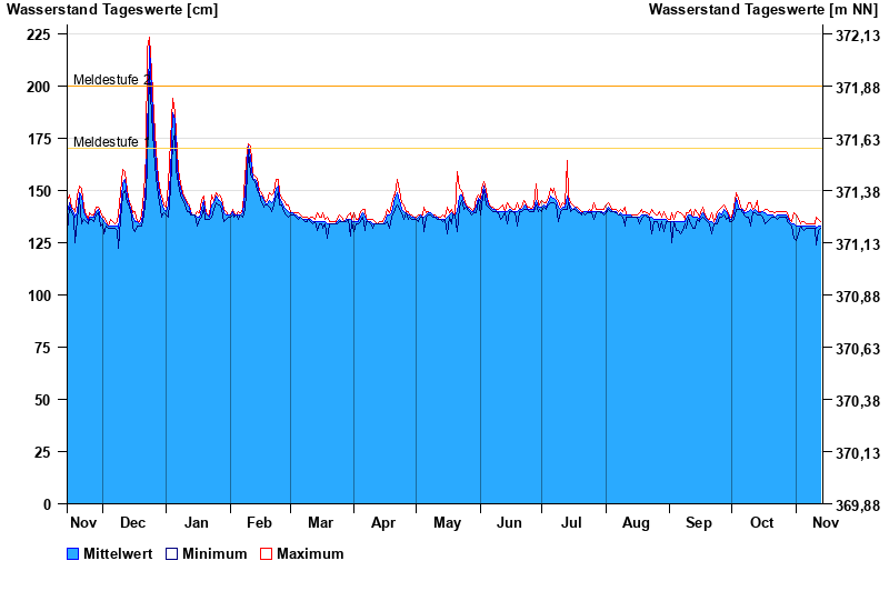
- Meldestufe 1 170 cm
- Meldestufe 2 200 cm
- Meldestufe 3 230 cm
- Meldestufe 4 260 cm
- Hochwassergefahrenfläche HQhäufig 240 cm
- Hochwassergefahrenfläche HQ100 330 cm
| Datum | Mittelwert [cm] | Maximum [cm] | Minimum [cm] |
|---|---|---|---|
| 13.11.2024 | 133 | 135 | 132 |
| 12.11.2024 | 133 | 136 | 131 |
| 11.11.2024 | 132 | 137 | 124 |
| 10.11.2024 | 133 | 134 | 132 |
| 09.11.2024 | 133 | 134 | 132 |
| 08.11.2024 | 133 | 134 | 132 |
| 07.11.2024 | 133 | 134 | 132 |
© Bayerisches Landesamt für Umwelt 2025